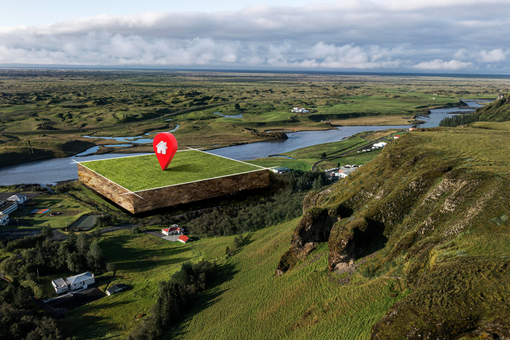
How to Show Property Lines on Google Earth
Google Earth is a powerful tool that allows users to explore the world from the comfort of their own homes. For homeowners, real estate professionals, and land surveyors, it can also be a valuable tool to visualize and understand property boundaries. In this comprehensive guide, we will walk you through the steps to show property lines on Google Earth, whether you're planning a landscaping project, verifying property boundaries, or simply curious about the dimensions of your land.
Understanding Property Boundaries
Before diving into the technical aspects of using Google Earth to display property lines, it's essential to grasp the importance of property boundaries. These lines define the legal limits of a property and play a crucial role in property ownership, land use, and various legal matters. Accurate knowledge of property boundaries is essential to avoid disputes with neighbours and ensure compliance with local zoning regulations.
Google Earth: A Versatile Mapping Tool
Google Earth is a widely accessible mapping and visualization tool that allows users to view satellite imagery, explore geographical features, and even measure distances. While it's not a replacement for professional land surveys or legal documents, it can serve as a helpful preliminary tool for property owners and real estate professionals.
Step-by-Step Guide to Showing Property Lines on Google Earth
Now, let's delve into the steps to display property lines on Google Earth. Please note that Google Earth's features and capabilities may change over time, so it's essential to use the most up-to-date version of the software.
- Install Google Earth Pro
If you haven't already, download and install Google Earth Pro on your computer. Google Earth Pro is a free application available for Windows, macOS, and Linux. It offers advanced mapping features compared to the web-based version of Google Earth.
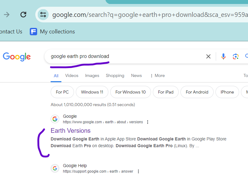
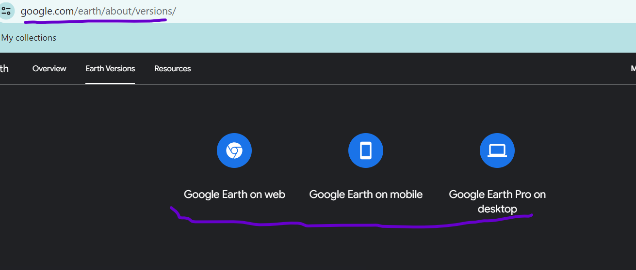
Then, select a version ( Mobile, Apple or desktop); we selected the desktop version ( next image)
Once you have finished downloading, locate the executable file and proceed to double-click it in order to initiate the installation process for Google Earth Pro.
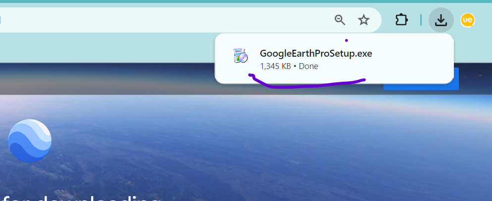
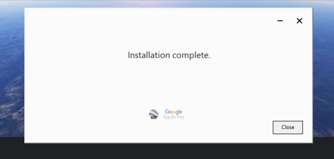
After installation, you should get the installation "completed " message
- Open Google Earth Pro
Launch Google Earth Pro by double-clicking its icon on your desktop or through your applications folder.
- Sign In or Create an Account
To access some of the advanced features, such as importing and saving data, sign in with your Google Account. If you don't have one, you can create a Google Account for free.
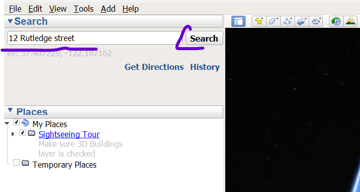
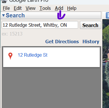
- Find Your Property
Use the search bar in Google Earth Pro to locate your property. You can enter your property's address, coordinates, or any other identifying information to zoom in on the area you're interested in.
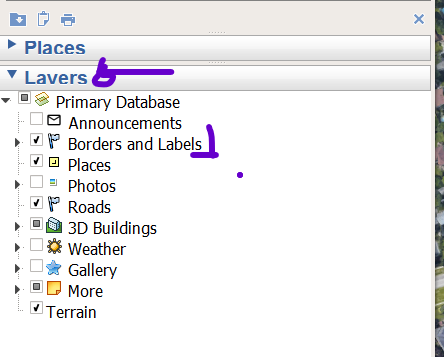
- Enable "Borders and Labels" Layer
On the left-hand side of the Google Earth Pro interface, you'll find a panel with various layers and options. Look for the "Layers" section and expand it if necessary. Check the box next to "Borders and Labels." This will overlay administrative boundaries, such as country borders and state or province lines, on the map.
- Import Property Lines (KML/KMZ File)
To display your specific property lines, you'll need a KML (Keyhole Markup Language) or KMZ (compressed KML) file that contains the boundary information. If you already have such a file, you can skip to the next step. If not, there are several ways to obtain one:
- Professional Survey: If you've had a professional land survey conducted, they may provide you with a KML/KMZ file of your property boundaries.
- Online GIS Databases: Some government agencies and municipalities provide access to GIS (Geographic Information System) databases that contain property boundary data. You can often download KML/KMZ files from these sources.
- Third-Party Services: Some online services offer property boundary information for a fee. These services may allow you to download KML/KMZ files.
- make KML/KMZ files with Google Earth Pro
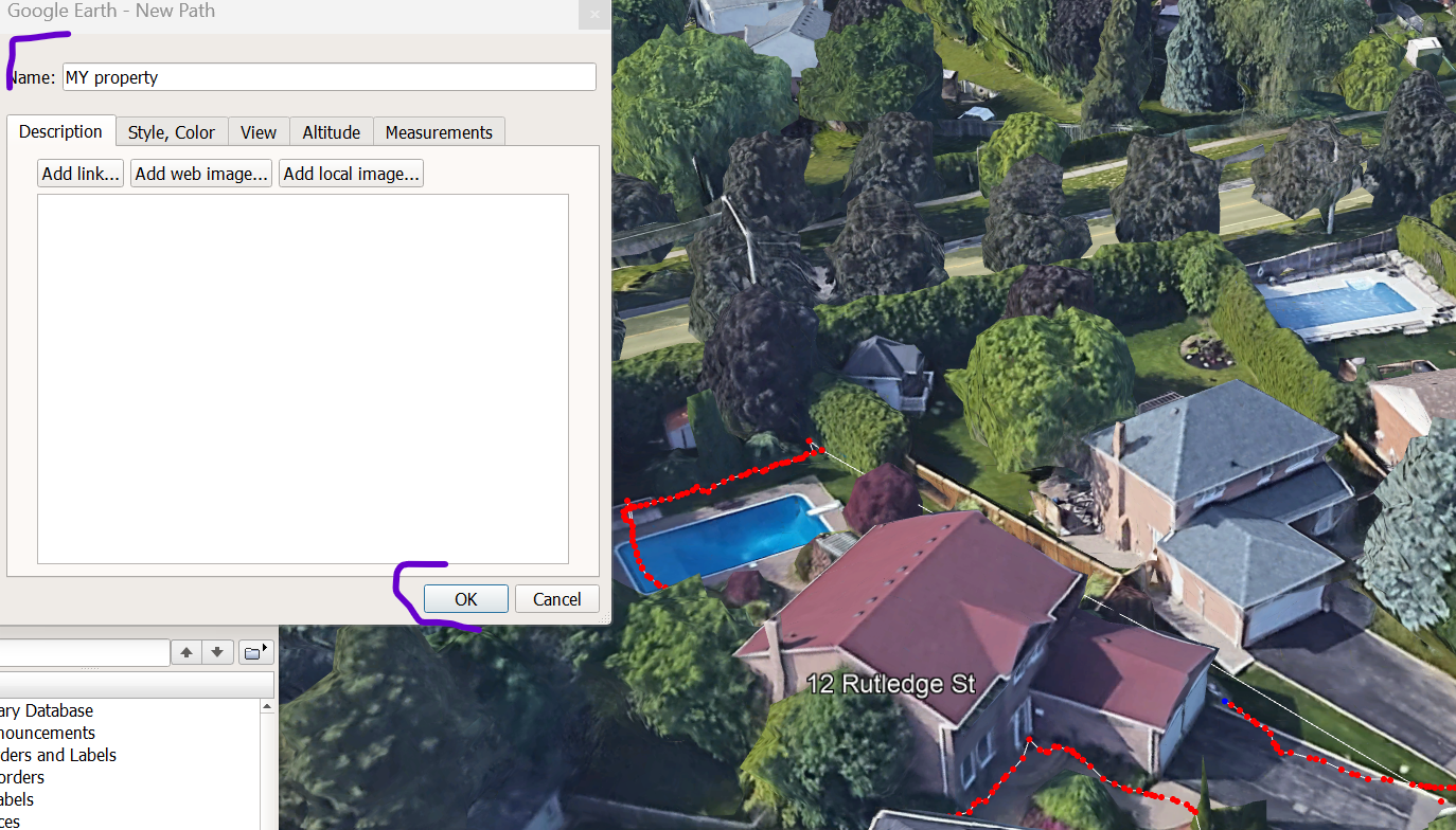
Before you begin the process of creating a new KML/KMZ file, it is essential to zoom in and enlarge your property as much as possible. This will allow you to clearly see all the different corners of your property. It is crucial to be able to click on these corners in order to create a boundary and obtain an accurate measurement.
Go to menu on Top and click on “Add” then select “Path”
A new window pops up: “Google Earth - New Path. “ Move the window out of the way.
Please mark or click on each corner of your property on the right panel (assuming you have zoomed in on the image). Once completed, provide a name for it in the pop-up window and click on "Ok." We refer to this as "my property."
Now, if you check your left screen, you will see the name of your property
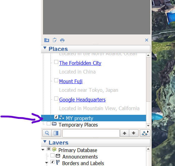
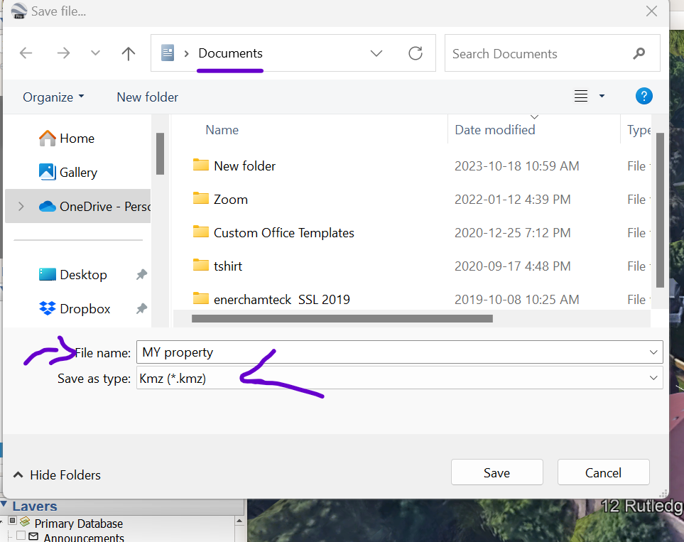
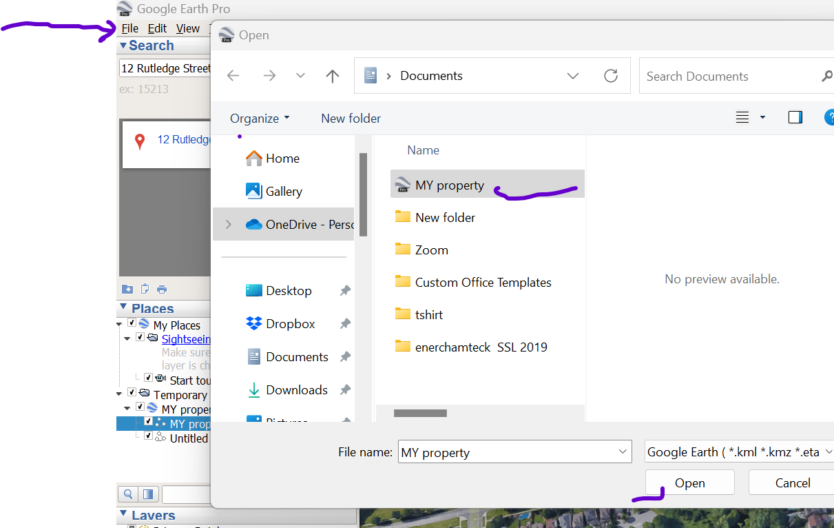
Firstly, locate the recently created "Path" file by performing a right-click. In this instance, let's refer to it as "my property". After right-clicking, opt for the "Save place as" option. Proceed to save this file as a KML/KMZ file on your computer. You can choose any desired location, but for our purposes, let's save it in the "document" folder.
- Open the KML/KMZ File
With your property boundary KML/KMZ file ready, go to the "File" menu in Google Earth Pro and select "Open." Locate the file on your computer and open it. The property lines will now be displayed on the map.
- Customize Property Lines
You can customize the appearance of the property lines to make them more visible and distinguishable from other map elements. Right-click on the imported KML/KMZ file in the "Places" panel on the left-hand side of the interface. Select "Properties" from the context menu, where you can adjust the line color, style, and thickness.
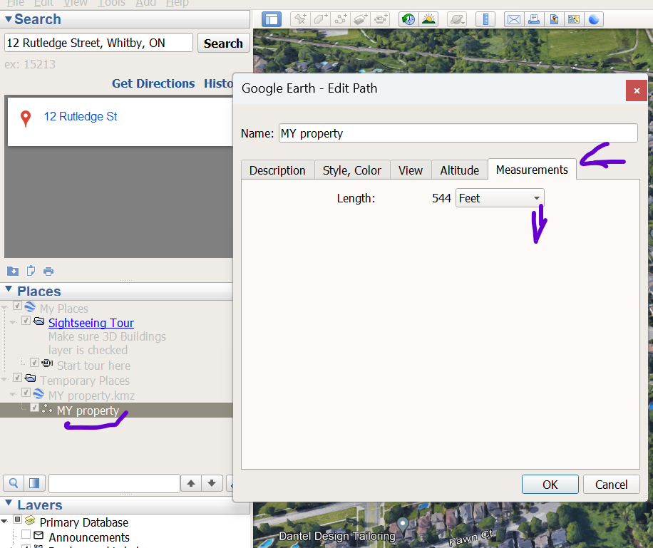
- Measure Distances and Areas
Google Earth Pro allows you to measure distances and areas on the map, which can be useful for understanding the size and dimensions of your property. To do this, click on the "Tools" menu and select "Ruler." You can then choose between measuring distances or areas by clicking on the respective option.
Quick view: right-click on the file select “Properties” and click on “ Measurements” to see different Martix
- Save and Share
If you want to save the displayed property lines for future reference or share them with others, you can save the entire Google Earth project as a KML/KMZ file. Simply go to "File" and select "Save" or "Save Place As."
You can share the file easily in different ways. Find the file and send it as attachment or uploaded on whatsapp etc.
Important Considerations
Accuracy: While Google Earth is a valuable tool, it is not a substitute for professional land surveys or legal documents. The accuracy of property boundaries displayed on Google Earth may vary, and they should be used for reference purposes only.
Legal Boundaries: Property boundaries may be subject to legal definitions and disputes. Always consult official property records and consider hiring a licensed land surveyor for precise boundary determinations.
Privacy: Be mindful of privacy concerns when sharing property boundary information. Avoid sharing sensitive data without consent.
Updates: Google Earth's imagery and mapping data are regularly updated, so property lines displayed may change over time.
To sum up, Google Earth is a powerful tool that can help property owners and real estate professionals visualize property boundaries and better understand a location's geographical features. While it's not a substitute for professional land surveys or legal documents, it offers a user-friendly way to explore and display property lines. Remember to use the most up-to-date version of Google Earth Pro and exercise caution in relying solely on its information for legal or surveying purposes.
Now that you know how Google Earth works, how about you work on your Google My Business and outsmart your local competition in Toronto with local SEO and short video marketing?
We know how to do them. Unlimited Online Exposure, an affordable web development company in Toronto, has gained a strong reputation in the industry over 27 years. Renowned as pioneers, they have an impressive track record of successfully creating over 1400 websites.
Unlimited Online Exposure is fully dedicated to providing a wide range of services in Toronto. These services include producing short videos for TiTok, social media marketing, content creation and marketing, chatbot integration for websites, customer relationship management (CRM) implementation, inbound marketing, and Local SEO. Each service is designed to boost brand visibility and drive online business success.
To connect with Unlimited Online Exposure, you can easily search for "digital marketing agency near me" on the internet. Alternatively, you can contact us at 416-477-0594 or visit our website to better understand how they can elevate your brand. Your journey toward digital success begins with a trusted partner with the expertise to navigate the ever-evolving realm of online exposure and marketing.
